
Activities
Near Tower Hill
Make it a longer stay. Tower Hill, Mathinna and Fingal have plenty to explore.
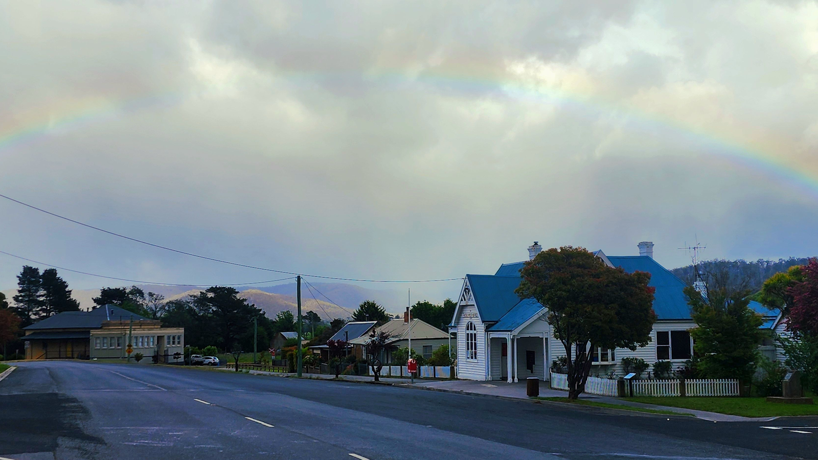
Part of Valley of Adventures. Our Valley of Adventures guide lists places to stay, eat and explore across the valley, with filters by town and category.
Make it a longer stay

Once the hunting's done there's a whole lot to explore around Tower Hill, Mathinna and Fingal, so pack the walking boots and the fishing rod and stay a few extra days. Drive times below are rough guides only.
Our shop at Fingal Post Office, Fingal
Grab supplies, our farm produce and post on your way in.
Mathinna Country Club, Mathinna
Dinner and drinks, or takeaway pizza and drinks. It's our local community pub, with fuel and live music now and then. Check their page for opening hours.
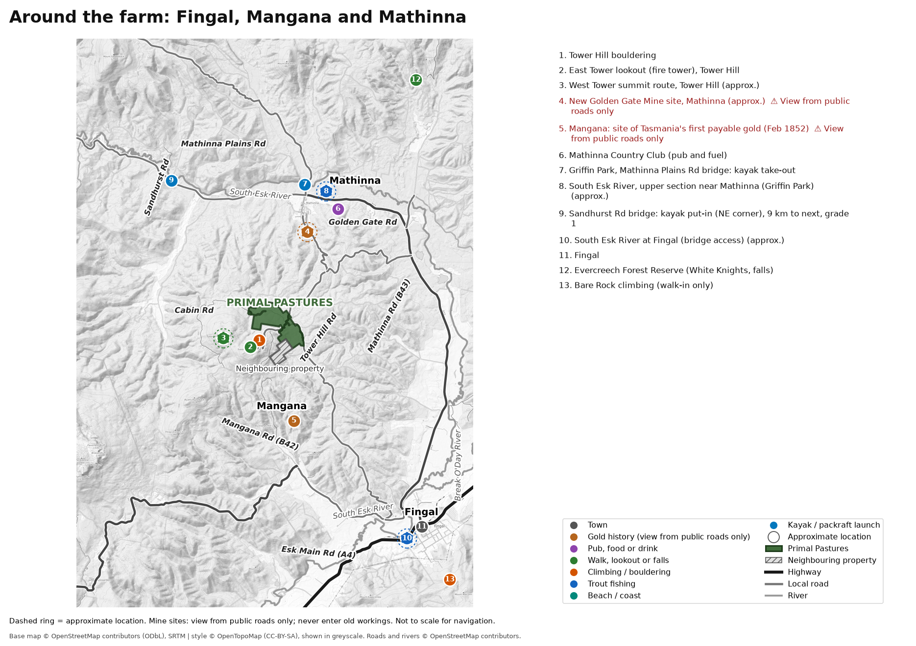
- 1. Tower Hill bouldering
- 2. East Tower lookout (fire tower), Tower Hill
- 3. West Tower summit route, Tower Hill (approx.)
- 4. New Golden Gate Mine site, Mathinna (approx.) Old workings: stay well clear.
- 5. Mangana: site of Tasmania's first payable gold (Feb 1852) Old workings: stay well clear.
- 6. Mathinna Country Club (pub and fuel)
- 7. Griffin Park, Mathinna Plains Rd bridge: kayak take-out
- 8. South Esk River, upper section near Mathinna (Griffin Park) (approx.)
- 9. Sandhurst Rd bridge: kayak put-in (NE corner), 9 km to next, grade 1
- 10. South Esk River at Fingal (bridge access) (approx.)
- 11. Fingal
- 12. Evercreech Forest Reserve (White Knights, falls)
- 13. Bare Rock climbing (walk-in only)
Interactive area map
Tap a layer to show or hide it, then tap a symbol for details and a link. Dashed rings are approximate. Pins are guides only, not for navigation.
Base map: our own area map. Base © OpenStreetMap contributors (ODbL), SRTM, style © OpenTopoMap (CC-BY-SA). Rivers and creeks © OpenStreetMap contributors (ODbL). Map library: Leaflet (BSD-2).
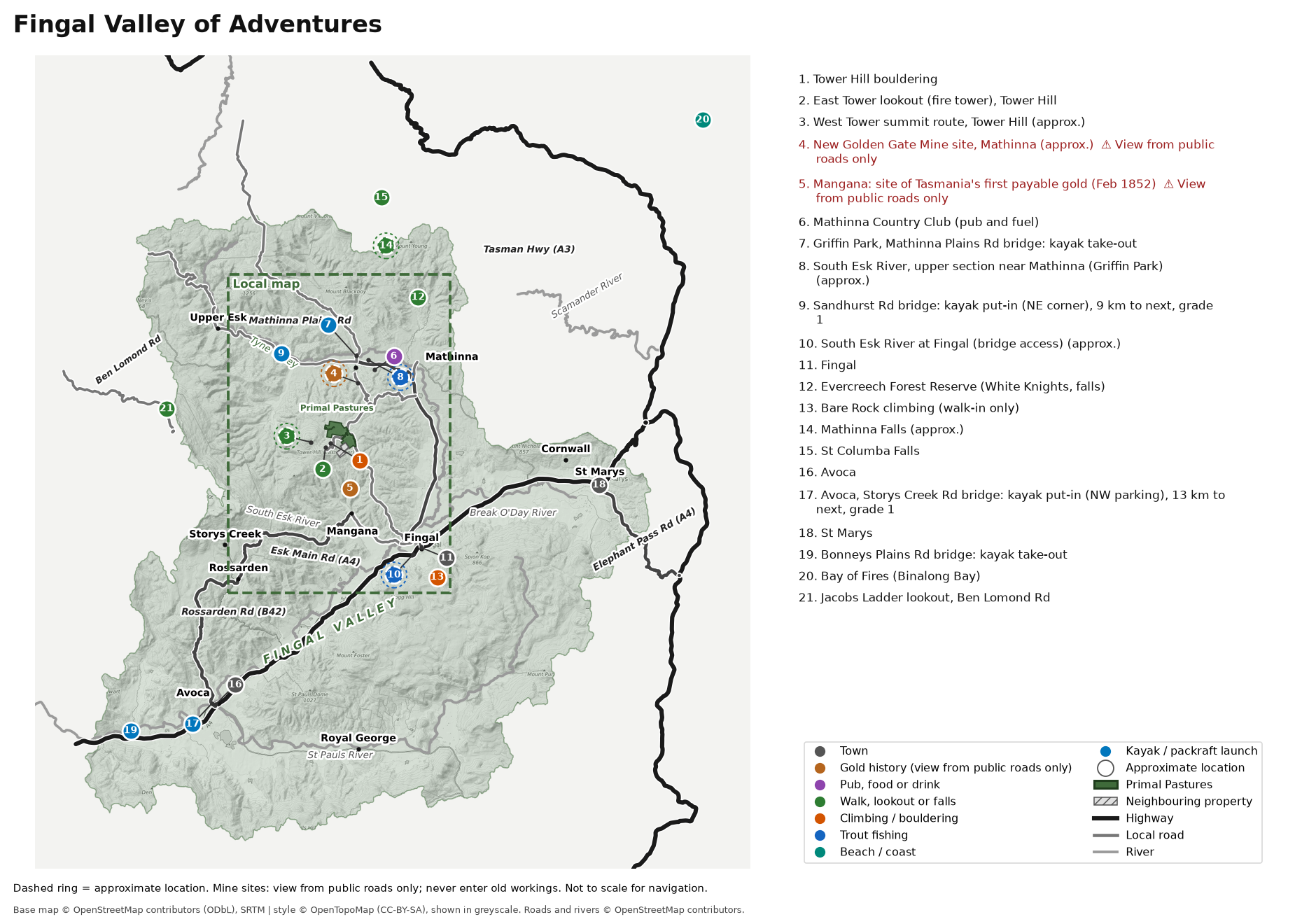
- 1. Tower Hill bouldering
- 2. East Tower lookout (fire tower), Tower Hill
- 3. West Tower summit route, Tower Hill (approx.)
- 4. New Golden Gate Mine site, Mathinna (approx.) Old workings: stay well clear.
- 5. Mangana: site of Tasmania's first payable gold (Feb 1852) Old workings: stay well clear.
- 6. Mathinna Country Club (pub and fuel)
- 7. Griffin Park, Mathinna Plains Rd bridge: kayak take-out
- 8. South Esk River, upper section near Mathinna (Griffin Park) (approx.)
- 9. Sandhurst Rd bridge: kayak put-in (NE corner), 9 km to next, grade 1
- 10. South Esk River at Fingal (bridge access) (approx.)
- 11. Fingal
- 12. Evercreech Forest Reserve (White Knights, falls)
- 13. Bare Rock climbing (walk-in only)
- 14. Mathinna Falls (approx.)
- 15. St Columba Falls
- 16. Avoca
- 17. Avoca, Storys Creek Rd bridge: kayak put-in (NW parking), 13 km to next, grade 1
- 18. St Marys
- 19. Bonneys Plains Rd bridge: kayak take-out
- 20. Bay of Fires (Binalong Bay)
- 21. Jacobs Ladder lookout, Ben Lomond Rd
Safety first: old mines and private land

This is gold country, and the old workings are part of the story. They're also dangerous.
- Open shafts can kill. Many old shafts and adits round here are open, unfenced and overgrown, and some go down hundreds of metres. The New Golden Gate main shaft at Mathinna went to about 580 m.
- Ground near old workings can collapse without warning, and bad air collects underground.
- Stay well clear. Never go into a shaft or tunnel. Keep kids and dogs close. View old sites only from public roads or lookouts.
- No entry to private land, a mining lease or an old mine without the owner's permission. Ever.
- The old mining was across the road from us, not on our farm.
Kayaking and paddling
Kayaking and packrafting on the South Esk: two easy grade 1 runs nearby (best after rain, so check river levels on the BOM site first). Upper Esk near Mathinna: Sandhurst Rd bridge to Griffin Park (Mathinna Plains Rd bridge), about 9 km. Avoca: Storys Creek Rd bridge to Bonneys Plains Rd bridge, about 13 km. Paddleboards and canoes suit these runs too. Experienced paddlers only. Follow MAST safety rules, and ask before crossing private land.

Prospecting, gold mines and gold history
A little gold history
In February 1852 James Grant of Tullochgorum found Tasmania's first payable gold on Richardsons Creek near Mangana, just ~5 minutes from us. About 200 people rushed in. In April 1859 the Sovereign mine at Mangana became Tasmania's first lode (reef) gold mine, and in 1869 a reef was found on Tower Hill itself.

The big one was the Golden Gate at Mathinna, worked from 1888 to 1932. It produced about 7.9 tonnes (253,865 oz) of gold, making it the largest gold mine in north-east Tasmania and the second largest in the state after Beaconsfield. Drive through Mathinna today and it's hard to picture how busy it once was.
Read more: the history of Tower Hill and surrounds.
Prospecting, fossicking and metal detecting
Keen to try your luck nearby? Each guest aged 18 or over needs their own Prospecting Licence from Service Tasmania. Check the current fee with Mineral Resources Tasmania (opens in a new tab) (under 18s can prospect with a licensed adult).
- Where. Prospecting is allowed in parts of the Mathinna, Tower Hill and Mangana goldfields on Crown land and state forest, subject to the land manager and the consent of the tenement holder. No prospecting or metal detecting in national parks or reserves, or in historic sites. Check MRT's Prospecting Access Map Viewer before you go.
- How. Hand tools and metal detectors only, less than 2 m deep. Metal detectors are allowed wherever prospecting is allowed, except in designated fossicking areas and on reserved land. Fill every hole and leave creek banks as you found them.
- Private land. Landowner permission required (in writing where a mineral tenement applies).
- Old shafts kill. The goldfields are riddled with old shafts and adits, many hidden by scrub or rotten covers. Stay well clear, never enter old workings, and keep kids and dogs close.
Tower Hill bouldering


Tower Hill bouldering: around 10 large boulders with about 78 problems below East Tower, a short walk from Cabin Road. Details on theCrag
Bare Rock, Fingal

Fishing on the South Esk
The upper South Esk near Mathinna (~10 min) is a lovely little river to wade for small brown trout on fly, lure or bait. Further down at Fingal (~20 min) there are glides and broadwaters with bridge access. You'll need an Inland Angling Licence if you're 14 or over. Trout season above the Storys Creek Rd bridge at Avoca runs from 1 August 2026 to 2 May 2027. Use the signed Anglers Access points and ask permission anywhere else.
Tower Hill walks and lookouts


For East Tower, West Tower and other walks nearby, see Hiking.
Mathinna Country Club and events
The Mathinna Country Club is our local community pub, for dinner and drinks or takeaway pizza, with fuel and live music now and then.
Keep an eye on the Mathinna Country Club for live music nights.
Further afield
Make a day of it: St Marys (~35 min), St Columba Falls (~40 min), Scamander beach (~45 min), and Bay of Fires and Bicheno (~65 min plus).

The passes
St Marys Pass

Elephant Pass

Jacobs Ladder

Credits: Tasmanian 2 m elevation data (The LIST, CC BY 3.0 AU) and OpenStreetMap contributors (ODbL).
Check dates and book Times, induction and the booking form are all on the booking page.
Hiking
East Tower, West Tower and other walks near the farm now have their own page.